
The Yonaguni monument: ruin or rock?

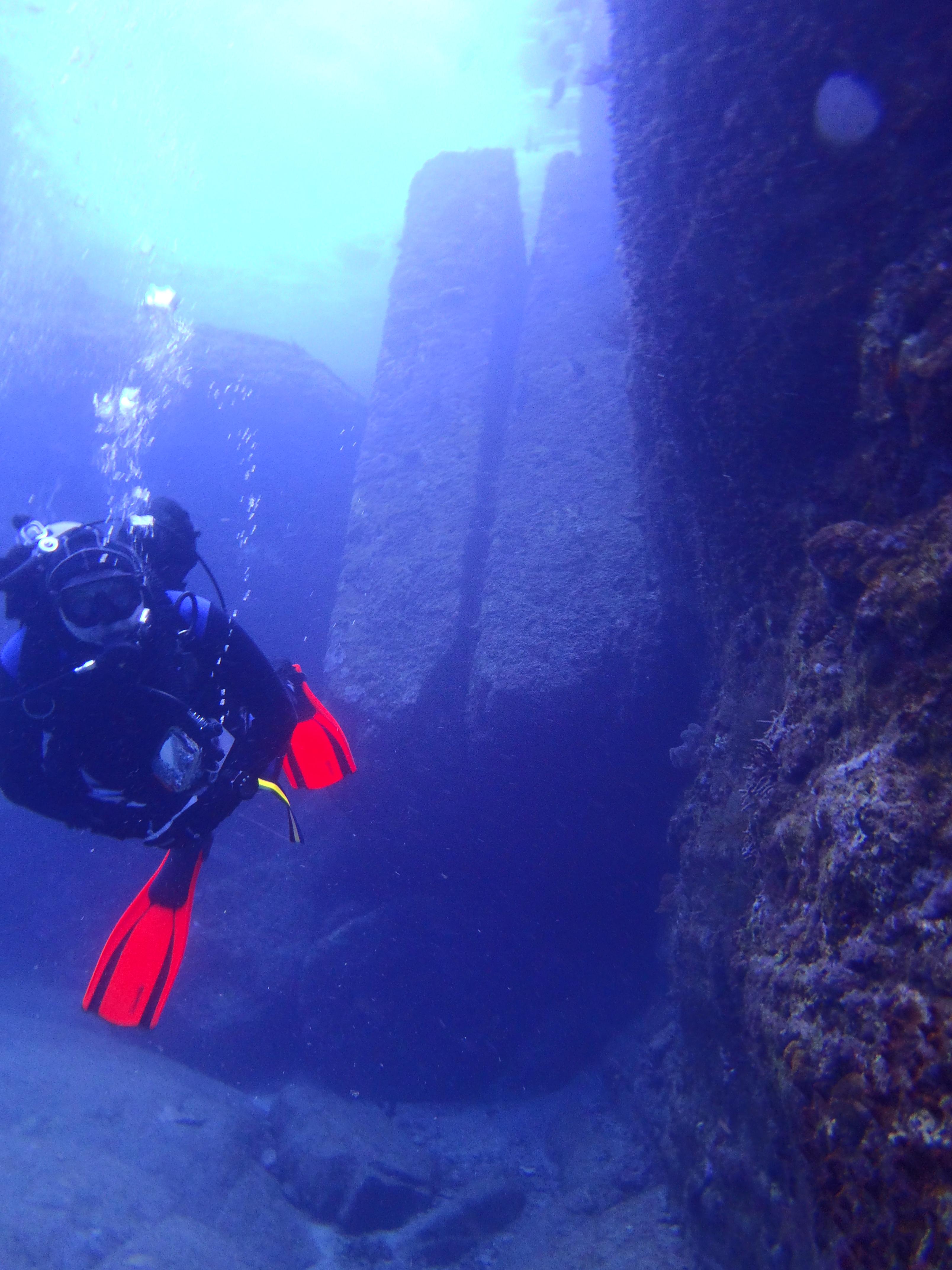

In 1986 a local diver off Yonaguni, the island at Japan's westernmost point, came across a stepped structure on the seabed. Whether people or nature shaped it is still argued: a 2026 report in the Ryukyu Shimpo said many points remain unresolved.1,2,3,4
A diver's find in 1986
Masaaki Kimura, writing in 2004, credits local diver Kihachiro Aratake with finding the stepped structure by chance in 1986 and naming the spot Iseki Point, or ruins point. The geologist Robert Schoch also names Aratake as the discoverer, and says Aratake guided his own dives there. National Geographic and Okinawa's official travel guide both give the year as 1986.2,3,5,6
According to ExplorersWeb, Aratake was diving to look for the hammerhead sharks found around the island. A promontory on Yonaguni was later unofficially renamed Iseki Hanto, Ruins Point.3,7
What divers see
Schoch puts the top of the structure about 5 m below the surface and its base at about 25 m. Kimura describes the largest structure as a complicated, stepped monolith rising from 25 m, with stepped slopes that look like a castle wall, and a 'road' that turns at almost a right angle.2,3,5,8
Published sizes differ. National Geographic, in its 2007 article on Kimura's survey, gave the whole area as about 300 by 150 m, while Japan's national tourism organisation describes a formation of 100 by 60 m standing about 25 m tall. The rock itself, according to Schoch, is medium to very fine sandstone and mudstone of the Lower Miocene Yaeyama Group. It splits easily along parallel bedding planes and is crossed by sets of parallel, vertical joints.3,5,9
The case for a man-made monument
Kimura, a marine geologist at the University of the Ryukyus, argues that the site is artificial. In 2004 he wrote that his group had concluded Iseki Point should be regarded as a man-made ruin. In a conference paper the same year he called tool marks in the stone the strongest evidence for a human origin.2,3,8
His interpretation goes well beyond a single block: he has described a castle, a triumphal arch and five temples. He told National Geographic in 2007 that it is very difficult to explain the site as purely natural.3
His dating has shifted. The 2004 paper estimated the formation of Iseki Point at about 10,000 years ago. In 2007 National Geographic reported that he believed the ruins were at least 5,000 years old, and framed the idea as a city sunk by an earthquake about 2,000 years ago.3,8
The case for natural rock
Schoch, then a professor of science and mathematics at Boston University, dived the site in September 1997 and again in July and August 1998. In 1999 he wrote that his working hypothesis was that the monument is primarily natural, while allowing that it may have been modified by people in ancient times. He told National Geographic in 2007 that he knew it was not artificial the first time he dived it, calling it basic geology and classic stratigraphy for sandstones.3,5
In his view the site's shapes follow from this layered, jointed sandstone. He also said the site is less regular than often claimed, with right angles and symmetry that do not add up in many places, and he reported very regular step-like and terrace-like shapes formed by natural wave and tidal action in the same rock on the island's coasts.3,5
ExplorersWeb describes the natural explanation as the more widely accepted theory. Kimura, for his part, maintains that tool marks in the stone point to human work.7,8
Official status
In 2007 National Geographic reported that neither Japan's Agency for Cultural Affairs nor the Okinawa Prefecture government recognised the remains as an important cultural property. The formations belong to the district of Yonaguni, and tourists and researchers could dive there freely.3
Kimura himself complained in 2004 that no protective measures had been taken. ExplorersWeb wrote in 2023 that the structure has no special protection from the Japanese government, which is why divers can visit it freely.2,7
Diving it today
The site can still be seen by diving or from a glass-bottom boat. Sources disagree on the level needed: Okinawa's official guide lists the Underwater Ruins at 25 m with occasionally strong current and rates it for beginners, while the dive magazine Marine Diving gives a maximum depth of 17 m, currents that are sometimes strong, and a level of intermediate and above. Japan's tourism organisation warns of powerful currents and says some experience is needed.4,6,9,10
Marine Diving notes that the ruins, on the island's south side, can be dived in winter when north winds close other sites, and recommends December to May for divers who want to dive the ruins and Irizaki. Okinawa's official guide says hammerhead sharks can be seen on drift dives at Hammerhead Rock from around November through early May; the current there is swift.6,10
- Ask your operator what experience it requires: published ratings range from beginner to intermediate.6,10
- Expect currents that can be strong at the ruins.6,9,10
- Hammerheads can be spotted on drift dives at Hammerhead Rock from around November to early May; the current there is swift.6
- Winter north winds can close other sites; the ruins are often still diveable.10
Sources
- 1. jstage.jst.go.jp
- 2. spf.org
- 3. nationalgeographic.com
- 4. ryukyushimpo.jp
- 5. circulartimes.net
- 6. visitokinawajapan.com
- 7. explorersweb.com
- 8. kimuramasaaki.sakura.ne.jp
- 9. japan.travel
- 10. en.marinediving.com
Sources checked on 19 November 2026. Written from these pages and checked by an independent second reader.
Where to dive next month
One email a month, around the 25th: the destinations in season the following month, with their sources, an article to read and an instructor's tip. Free, no ads.